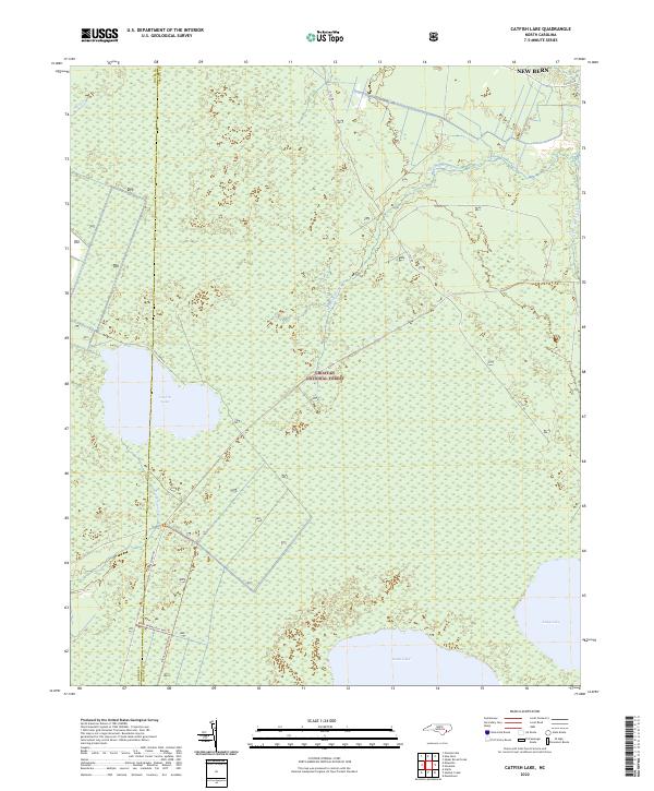
2022 Map of Catfish Lake
USGS Topo · Published 2022About this map
Croatan National Forest dominates this landscape on the border of Jones and Craven counties, defined by the pocosin wetlands and lakes characteristic of the coastal plain. The large, shallow waters of Catfish Lake, Great Lake, and Long Lake are primary landmarks within the preserve, surrounded by the expansive Black Swamp. This environment supports a network of forest management and recreation routes, including the Black Swamp Ohv Trl and the Black Swamp Ohv Spur Trl, which navigate the saturated terrain. Hydrology is governed by the headwaters of Brice Cr, with its W Prong Brice Cr and E Prong Brice Cr reaching into the northern reaches of the forest near New Bern. The presence of Cat Fish Farm Rd and Little Rd indicates the sparse but vital infrastructure used to access these protected wetlands.
Find a feature on this map
18 named features on this map. Tap any name to fly to it.
Don’t see what you’re looking for? This feature index may not catch every label — zoom into the map to look around manually.
Map Details
Editions of this 2022 Catfish Lake Map
This is the sole edition of this map. No revisions or reprints were ever made.
Other maps of this area

1901 · New Bern
USGS Topo · 1:62,500

1903 · New Bern
USGS Topo · 1:62,500

1942 · Maysville
USGS Topo · 1:62,500

1948 · Maysville
USGS Topo · 1:62,500

1949 · Havelock
USGS Topo · 1:24,000

1949 · Masontown
USGS Topo · 1:24,000

1950 · Pollocksville
USGS Topo · 1:24,000

1950 · New Bern
USGS Topo · 1:24,000

1950 · Upper Broad Creek
USGS Topo · 1:24,000

1951 · Masontown
USGS Topo · 1:24,000