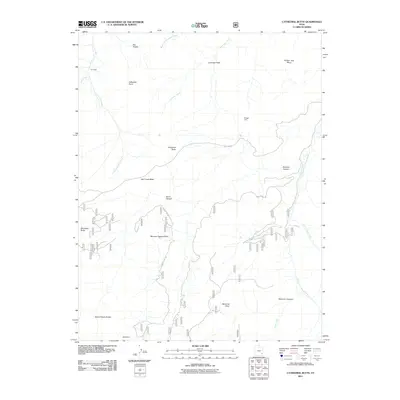
2011 Map of Cathedral Butte
USGS Topo · Published 2011About this map
Kirk Cabin stands as a lone named settlement marker in this high-desert landscape of San Juan County, Utah, where isolated outposts and resource extraction define the human footprint. The terrain is dominated by massive flat-topped formations such as Bridger Jack Mesa and Salt Creek Mesa, while the southern reaches of the map show the industrial history of the area at the Betty Mine. Deep incisions like Stevens Canyon and Davis Canyon carve through the plateau, creating a complex drainage network that feeds into Salt Creek and North Cottonwood Creek. The presence of Mormon Pasture Point and Seven Sisters Buttes suggests a landscape shaped by both traditional grazing uses and distinctive geological landmarks. This survey captures a moment when remote forest access via Forest Road 092 and Beef Basin provided the primary means of navigating this expansive and segmented canyon country.
Find a feature on this map
26 named features on this map. Tap any name to fly to it.
Don’t see what you’re looking for? This feature index may not catch every label — zoom into the map to look around manually.
Map Details
Editions of this 2011 Cathedral Butte Map
This is the sole edition of this map. No revisions or reprints were ever made.
Other maps of this area

1885 · La Sal
USGS Topo · 1:250,000

1886 · Abajo
USGS Topo · 1:250,000

1892 · Abajo
USGS Topo · 1:250,000

1893 · Abajo
USGS Topo · 1:250,000

1935 · Elk Ridge
USGS Topo · 1:96,000

1940 · Elk Ridge
USGS Topo · 1:125,000

1953 · The Needles
USGS Topo · 1:62,500

1954 · Elk Ridge 1 SW
USGS Topo · 1:24,000

1954 · Elk Ridge 2 SE
USGS Topo · 1:24,000

1954 · Elk Ridge 1 NW
USGS Topo · 1:24,000