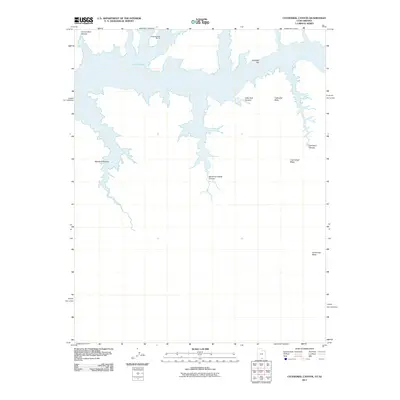
2011 Map of Cathedral Canyon
USGS Topo · Published 2011About this map
Lake Powell dominates the northern half of this landscape along the border of Arizona and Utah, where the reservoir has filled the intricate network of the Colorado River's ancient drainage. The primary outpost for boaters in this section of the Glen Canyon National Recreation Area is Dangling Rope Marina, accessible only by water. South of the shoreline, the terrain rises sharply toward the expansive high ground of Cummings Mesa. The map illustrates a complex topography of named drainages including Wetherill Canyon and Mountain Sheep Canyon, which cut deep into the sandstone plateau. Landmarks such as Cathedral Butte and the winding course of Cathedral Canyon highlight the geological character of this region, while names like Klondike Bar suggest the area's history of river-based exploration and prospecting.
Find a feature on this map
10 named features on this map. Tap any name to fly to it.
Don’t see what you’re looking for? This feature index may not catch every label — zoom into the map to look around manually.
Map Details
Editions of this 2011 Cathedral Canyon Map
This is the sole edition of this map. No revisions or reprints were ever made.
Other maps of this area

1883 · Marsh Pass
USGS Topo · 1:250,000

1886 · Escalante
USGS Topo · 1:250,000

1886 · Henry Mountains
USGS Topo · 1:250,000

1886 · Echo Cliffs
USGS Topo · 1:250,000

1891 · Echo Cliffs
USGS Topo · 1:250,000

1892 · Marsh Pass
USGS Topo · 1:250,000

1892 · Henry Mountains
USGS Topo · 1:250,000

1953 · Cummings Mesa
USGS Topo · 1:62,500

1953 · Navajo Mountain
USGS Topo · 1:62,500

1954 · Navajo Creek
USGS Topo · 1:62,500