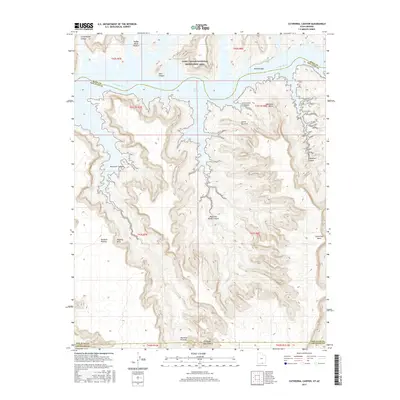
2017 Map of Cathedral Canyon
USGS Topo · Published 2017About this map
The Colorado River and the expansive waters of Lake Powell dominate the northern landscape of this 2017 survey, where the river serves as the defining boundary between Kane, San Juan, and Coconino counties. Managed within the Glen Canyon National Recreation Area, this high-desert terrain is characterized by massive plateaus and intricate drainage systems. The southern portion of the map is anchored by the Rainbow Plateau and the elevated heights of Cummings Mesa, showing the complex verticality of the Arizona-Utah border region.
Find a feature on this map
27 named features on this map. Tap any name to fly to it.
Don’t see what you’re looking for? This feature index may not catch every label — zoom into the map to look around manually.
Map Details
Editions of this 2017 Cathedral Canyon Map
This is the sole edition of this map. No revisions or reprints were ever made.
Other maps of this area

1883 · Marsh Pass
USGS Topo · 1:250,000

1886 · Escalante
USGS Topo · 1:250,000

1886 · Henry Mountains
USGS Topo · 1:250,000

1886 · Echo Cliffs
USGS Topo · 1:250,000

1891 · Echo Cliffs
USGS Topo · 1:250,000

1892 · Marsh Pass
USGS Topo · 1:250,000

1892 · Henry Mountains
USGS Topo · 1:250,000

1953 · Cummings Mesa
USGS Topo · 1:62,500

1953 · Navajo Mountain
USGS Topo · 1:62,500

1954 · Navajo Creek
USGS Topo · 1:62,500