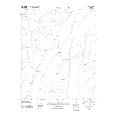
2011 Map of Catlett
USGS Topo · Published 2011About this map
The community of Naomi and the crossroads at Smith Gap anchor this portion of Walker County, where the landscape is defined by the ridge-and-valley topography of northwest Georgia. Numerous family and community burying grounds, including Shiloh Cemetery, Concord Cemetery, and Whitley Cemetery, are scattered throughout the hollows, providing essential data points for local genealogists. The water systems are well-defined, featuring Barwick Reservoir with the Barwick Mill Dam Two and the larger Lake Howard in the northwest corner.
Find a feature on this map
71 named features on this map. Tap any name to fly to it.
Don’t see what you’re looking for? This feature index may not catch every label — zoom into the map to look around manually.
Map Details
Editions of this 2011 Catlett Map
This is the sole edition of this map. No revisions or reprints were ever made.
Other maps of this area

1886 · Ringgold
USGS Topo · 1:125,000

1892 · Ringgold
USGS Topo · 1:125,000

1935 · Catlett
USGS Topo · 1:24,000

1935 · Villanow
USGS Topo · 1:24,000

1935 · Nickajack Gap
USGS Topo · 1:24,000

1935 · Tunnel Hill
USGS Topo · 1:24,000

1936 · Kensington
USGS Topo · 1:24,000

1936 · Estelle
USGS Topo · 1:24,000
1943 · Tunnel Hill
USGS Topo · 1:24,000

1946 · Kensington
USGS Topo · 1:24,000