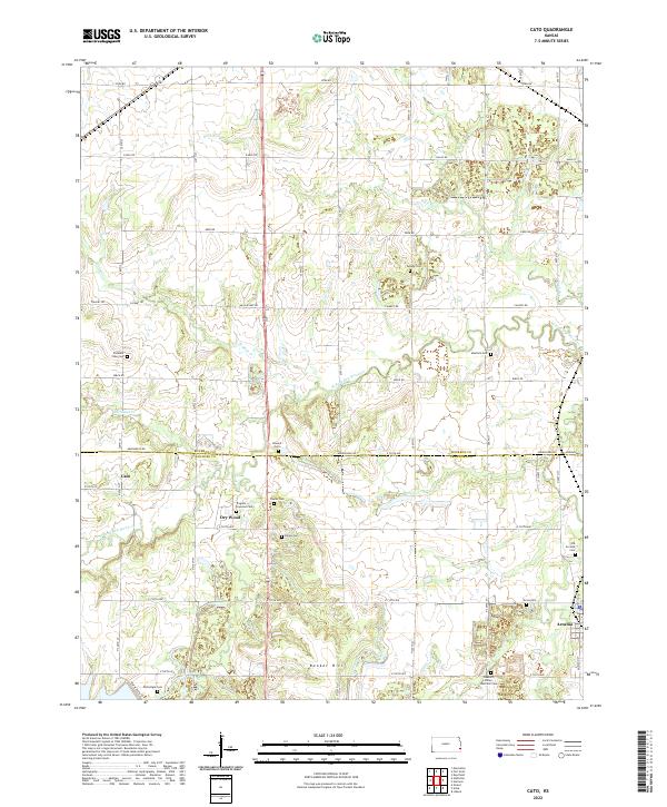
2022 Map of Cato
USGS Topo · Published 2022About this map
Arcadia and the small settlements of Cato and Dry Wood anchor this landscape along the border of Bourbon and Crawford counties. The terrain is defined by the winding paths of Walnut Cr and the W Fork Dry Wood Cr, which cut through the agricultural sections as they move toward the drainage of Buck Run and Richland Cr. A significant number of family and community burial grounds are scattered across these townships, providing essential data for genealogical research. Locations like the Trogdon Drywood Cem, McGonigle Cem, and Pleasant Valley Sheffield Cem offer a clear look at the dispersed nature of local history here. In the south, Bunker Hill stands as a primary topographical landmark, overlooking the rural road network that includes Fern Rd and Arrowhead Rd.
Find a feature on this map
41 named features on this map. Tap any name to fly to it.
Don’t see what you’re looking for? This feature index may not catch every label — zoom into the map to look around manually.
Map Details
Editions of this 2022 Cato Map
This is the sole edition of this map. No revisions or reprints were ever made.
Other maps of this area

1884 · Fort Scott
USGS Topo · 1:125,000

1886 · Fort Scott
USGS Topo · 1:125,000

1893 · Fort Scott
USGS Topo · 1:125,000

1939 · Deerfield
USGS Topo · 1:24,000

1942 · Deerfield
USGS Topo · 1:24,000

1947 · Joplin
USGS Topo · 1:250,000

1948 · Mulberry
USGS Topo · 1:62,500
1948 · Liberal
USGS Topo · 1:24,000

1948 · Girard
USGS Topo · 1:62,500
1948 · Garland
USGS Topo · 1:24,000