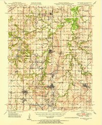
1948 Map of Mulberry
USGS Topo · Published 1954About this map
Mulberry and the surrounding borderlands of Kansas and Missouri are defined by a complex network of strip mines and industrial activity at the end of the 1940s. The landscape is dotted with numerous small settlements and rural education centers, including the Breezy Hill Sch, Coal Valley Sch, and Cockerill Sch, which served the families of miners and farmers. Heavy rail traffic from the St Louis - San Francisco, Kansas City Southern, and Missouri Pacific railroads links the coal-producing areas to larger markets. Beyond the industrial excavations, family names are preserved through landmarks like Martin Mound and Haake Mound, while local spiritual and communal centers like McKill Chapel and Heaviside Cem provide valuable touchpoints for genealogical research in this hardworking pocket of the tri-state area.
Find a feature on this map
64 named features on this map. Tap any name to fly to it.
Don’t see what you’re looking for? This feature index may not catch every label — zoom into the map to look around manually.
Map Details
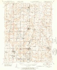
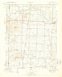
Editions of this 1948 Mulberry Map
2 editions found
Other maps of this area

1884 · Fort Scott
USGS Topo · 1:125,000

1886 · Nevada
USGS Topo · 1:125,000

1886 · Joplin
USGS Topo · 1:125,000

1886 · Fort Scott
USGS Topo · 1:125,000

1886 · Carthage
USGS Topo · 1:125,000

1893 · Fort Scott
USGS Topo · 1:125,000

1894 · Nevada
USGS Topo · 1:125,000

1894 · Joplin
USGS Topo · 1:125,000

1894 · Carthage
USGS Topo · 1:125,000
1939 · Deerfield
USGS Topo · 1:24,000