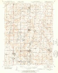
1948 Map of Mulberry
USGS Topo · Published 1954About this map
Strip mines dominate the landscape across the Kansas-Missouri border, revealing an era of intensive surface extraction during the late 1940s. The town of Mulberry sits at the heart of this industrial activity, surrounded by numerous coal-country settlements including Arma, Croweburg, and Franklin. This survey captures the region's dense network of rural infrastructure, with small country schools such as Breezy Hill Sch and Keplinger Sch serving the local families and miners. The transportation of coal is anchored by three major rail lines: the Missouri Pacific, St Louis - San Francisco, and Kansas City Southern. Beyond the industrial activity, the map records long-standing local landmarks like McKill Chapel and Heaviside Cem, providing a detailed view of Crawford and Bourbon counties before modern land reclamation changed the terrain.
Find a feature on this map
81 named features on this map. Tap any name to fly to it.
Don’t see what you’re looking for? This feature index may not catch every label — zoom into the map to look around manually.
Map Details
Editions of this 1948 Mulberry Map
2 editions found

Other maps of this area

1884 · Fort Scott
USGS Topo · 1:125,000

1886 · Nevada
USGS Topo · 1:125,000

1886 · Joplin
USGS Topo · 1:125,000

1886 · Fort Scott
USGS Topo · 1:125,000

1886 · Carthage
USGS Topo · 1:125,000

1893 · Fort Scott
USGS Topo · 1:125,000

1894 · Nevada
USGS Topo · 1:125,000

1894 · Joplin
USGS Topo · 1:125,000

1894 · Carthage
USGS Topo · 1:125,000

1939 · Deerfield
USGS Topo · 1:24,000