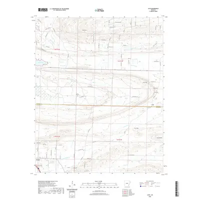
2020 Map of Cato
USGS Topo · Published 2020About this map
The Faulkner Co Pulaski Co border divides this Central Arkansas landscape, where the southern reaches of the Ozark foothills begin to subside into the Arkansas River Valley. The settlement of Cato serves as a local focal point near Cato Cem and the prominent Clifton Mtn, while the southwestern corner of the sheet features the community of Morgan and the sprawling military grounds of Camp Joseph Robinson. A complex network of drainage defines the terrain, with Bayou Meto and White Oak Bayou winding through the lowlands alongside numerous smaller tributaries like Jim Cr and Mile Cr. Natural and man-made water bodies including Lake Conway, Boone Pond, and Meers Lake illustrate the area's hydraulic character. Notable landmarks for genealogical research include Mount Psyam Cem and several family-named high points such as Wilson Hill and Jones Hill.
Find a feature on this map
85 named features on this map. Tap any name to fly to it.
Don’t see what you’re looking for? This feature index may not catch every label — zoom into the map to look around manually.
Map Details
Editions of this 2020 Cato Map
This is the sole edition of this map. No revisions or reprints were ever made.
Other maps of this area

1891 · Little Rock
USGS Topo · 1:125,000

1893 · Little Rock
USGS Topo · 1:125,000

1935 · Mc Almont
USGS Topo · 1:24,000

1935 · North Little Rock
USGS Topo · 1:24,000

1941 · Olmstead
USGS Topo · 1:31,680

1943 · Pinnacle Mtn
USGS Topo · 1:31,680

1953 · Cato
USGS Topo · 1:24,000

1953 · Mayflower
USGS Topo · 1:24,000
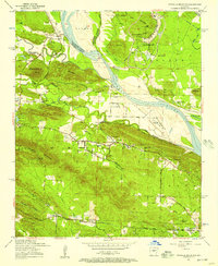
1954 · Pinnacle Mountain
USGS Topo · 1:24,000

1954 · Mc Almont
USGS Topo · 1:24,000