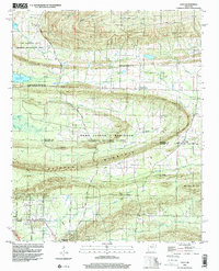
1994 Map of Cato
USGS Topo · Published 2000About this map
Camp Joseph T Robinson dominates the central landscape of this mid-1990s survey, straddling the border between Faulkner and Pulaski counties. The map captures a transition from the structured military grounds of the National Guard reservation to the residential and agricultural pockets of the Arkansas interior. Key landmarks like the Immaculate Heart of Mary Sch and the Mt Psyam Cemetery provide valuable anchor points for genealogical research, while rural crossroads like Brockington Corner and Gentry Corner suggest the area's local history of community development.
Find a feature on this map
53 named features on this map. Tap any name to fly to it.
Don’t see what you’re looking for? This feature index may not catch every label — zoom into the map to look around manually.
Map Details
Editions of this 1994 Cato Map
This is the sole edition of this map. No revisions or reprints were ever made.
Other maps of this area

1891 · Little Rock
USGS Topo · 1:125,000

1893 · Little Rock
USGS Topo · 1:125,000

1935 · Mc Almont
USGS Topo · 1:24,000

1935 · North Little Rock
USGS Topo · 1:24,000

1941 · Olmstead
USGS Topo · 1:31,680

1943 · Pinnacle Mtn
USGS Topo · 1:31,680

1953 · Cato
USGS Topo · 1:24,000

1953 · Mayflower
USGS Topo · 1:24,000
1954 · Pinnacle Mountain
USGS Topo · 1:24,000

1954 · Mc Almont
USGS Topo · 1:24,000