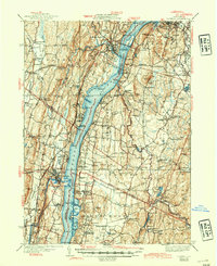
1941 Map of Catskill
USGS Topo · Published 1945About this map
The Hudson River serves as the central artery for this mid-century survey, dividing Greene and Columbia counties. The newly constructed Rip Van Winkle Bridge spans the water near Catskill, signifying the era's infrastructure growth alongside the heavy industrial presence of the New York Central RR. This sheet is particularly rich in Hudson Valley history, marking the Birthplace of Robert Livingston and prominent institutions like Bard College and the Potts Memorial Hospital.
Find a feature on this map
126 named features on this map. Tap any name to fly to it.
Don’t see what you’re looking for? This feature index may not catch every label — zoom into the map to look around manually.
Map Details
Editions of this 1941 Catskill Map
This is the sole edition of this map. No revisions or reprints were ever made.
Other maps of this area

1892 · Kaaterskill
USGS Topo · 1:62,500

1893 · Kaaterskill
USGS Topo · 1:62,500

1893 · Coxsackie
USGS Topo · 1:62,500

1893 · Durham
USGS Topo · 1:62,500

1894 · Coxsackie
USGS Topo · 1:62,500

1894 · Kaaterskill
USGS Topo · 1:62,500

1894 · Durham
USGS Topo · 1:62,500

1895 · Catskill
USGS Topo · 1:62,500

1898 · Rhinebeck
USGS Topo · 1:62,500

1899 · Kaaterskill
USGS Topo · 1:62,500