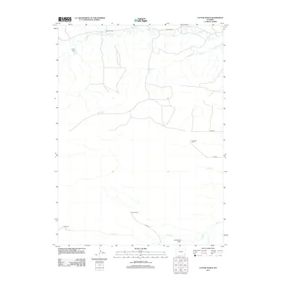
2012 Map of Cattail Ranch
USGS Topo · Published 2012About this map
The Griffin Homestead and several large cattle operations define this corner of Laramie County during the early 21st century. The landscape is marked by a complex network of ephemeral waterways and irrigation efforts, most notably the Durbin Ditch in the north and the wide Bullwhacker Draw to the south. Ranching lineage is visible through named properties like the L Kirkbride Ranch, D Kirkbride Ranch, and the namesake Cattail Ranch. These holdings are connected by a sparse grid of county roads, including Co RD-139 and Co RD-238, which traverse the open plains. The drainage pattern of Bear Cr, Horse Cr, and Cattail Cr illustrates the vital importance of water rights and management in this high-plains environment.
Find a feature on this map
17 named features on this map. Tap any name to fly to it.
Don’t see what you’re looking for? This feature index may not catch every label — zoom into the map to look around manually.
Map Details
Editions of this 2012 Cattail Ranch Map
This is the sole edition of this map. No revisions or reprints were ever made.
Other maps of this area

1899 · Goshen Hole
USGS Topo · 1:125,000

1911 · Cheyenne
USGS Topo · 1:125,000

1914 · Cheyenne
USGS Topo · 1:125,000

1954 · Cheyenne
USGS Topo · 1:250,000

1958 · Cheyenne
USGS Topo · 1:250,000

1960 · Diamond Flat
USGS Topo · 1:24,000

1960 · Rocky Hollow
USGS Topo · 1:24,000

1963 · Little Indian Draw
USGS Topo · 1:24,000

1963 · Midway
USGS Topo · 1:24,000

1963 · C S Ranch
USGS Topo · 1:24,000