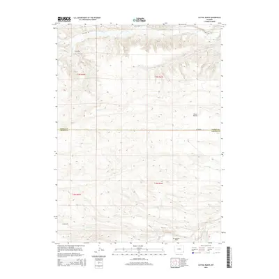
2015 Map of Cattail Ranch
USGS Topo · Published 2015About this map
Cattail Ranch sits at the heart of this high plains landscape along the border of Goshen and Laramie Counties. The terrain is defined by a network of seasonal drainages and irrigation improvements, including the Durbin Ditch and the winding course of Bear Cr. Distinctive landforms such as Bullwhacker Draw, Curly Run, and Rocky Hollow carve through the topography, reflecting the natural erosion patterns of the region. Transportation in this part of Wyoming is facilitated by a sparse grid of rural routes, including the descriptively named Missle Rd and Bear Creek Rd. The presence of these roads alongside scattered water sources like Cattail Cr and Spring Run illustrates the essential infrastructure required for ranching operations in this semi-arid environment during the early 21st century.
Find a feature on this map
21 named features on this map. Tap any name to fly to it.
Don’t see what you’re looking for? This feature index may not catch every label — zoom into the map to look around manually.
Map Details
Editions of this 2015 Cattail Ranch Map
This is the sole edition of this map. No revisions or reprints were ever made.
Other maps of this area

1899 · Goshen Hole
USGS Topo · 1:125,000

1911 · Cheyenne
USGS Topo · 1:125,000

1914 · Cheyenne
USGS Topo · 1:125,000

1954 · Cheyenne
USGS Topo · 1:250,000

1958 · Cheyenne
USGS Topo · 1:250,000

1960 · Diamond Flat
USGS Topo · 1:24,000

1960 · Rocky Hollow
USGS Topo · 1:24,000

1963 · Little Indian Draw
USGS Topo · 1:24,000

1963 · Midway
USGS Topo · 1:24,000

1963 · C S Ranch
USGS Topo · 1:24,000