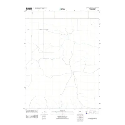
2012 Map of Cattail Ranch NE
USGS Topo · Published 2012About this map
Iowa Center Flats dominates the northern reaches of this Wyoming landscape, showing a high-plains topography defined by broad, flat expanses and seasonal drainage patterns. The area is intersected by a grid of county roads and local routes, including Road 24 and Road 213, which suggest a land partitioned for ranching and agricultural use in the early 21st century. The primary watercourse, Fox Cr, winds through the central and southern portions of the terrain, its meandering path creating the only significant breaks in the otherwise steady elevation. This 2012 survey by the U.S. Geological Survey illustrates the intersection of rural infrastructure with the natural drainage basins of Goshen County.
Find a feature on this map
12 named features on this map. Tap any name to fly to it.
Don’t see what you’re looking for? This feature index may not catch every label — zoom into the map to look around manually.
Map Details
Editions of this 2012 Cattail Ranch NE Map
This is the sole edition of this map. No revisions or reprints were ever made.
Other maps of this area

1899 · Goshen Hole
USGS Topo · 1:125,000

1954 · Cheyenne
USGS Topo · 1:250,000

1958 · Cheyenne
USGS Topo · 1:250,000

1960 · Diamond Flat
USGS Topo · 1:24,000

1960 · Needle Rock
USGS Topo · 1:24,000

1960 · Rocky Hollow
USGS Topo · 1:24,000

1963 · C S Ranch
USGS Topo · 1:24,000

1963 · Y B O Canyon
USGS Topo · 1:24,000
1963 · Cattail Ranch
USGS Topo · 1:24,000

1963 · Klutz Canyon
USGS Topo · 1:24,000