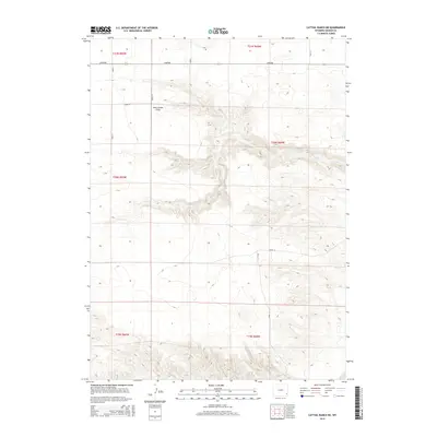
2015 Map of Cattail Ranch NE
USGS Topo · Published 2015About this map
Iowa Center Flats dominates the northern reaches of this Goshen County landscape, where the high plains begin to break into a complex system of drainages and canyons. The terrain is defined by dramatic elevation changes, notably at Klutz Canyon and Y B O Canyon which carve through the central sections of the quadrangle. Ranching heritage is central to this area, evidenced by the presence of the C S Ranch and the eponymous Cattail Ranch.
Find a feature on this map
25 named features on this map. Tap any name to fly to it.
Don’t see what you’re looking for? This feature index may not catch every label — zoom into the map to look around manually.
Map Details
Editions of this 2015 Cattail Ranch NE Map
This is the sole edition of this map. No revisions or reprints were ever made.
Other maps of this area

1899 · Goshen Hole
USGS Topo · 1:125,000

1954 · Cheyenne
USGS Topo · 1:250,000

1958 · Cheyenne
USGS Topo · 1:250,000

1960 · Diamond Flat
USGS Topo · 1:24,000

1960 · Needle Rock
USGS Topo · 1:24,000

1960 · Rocky Hollow
USGS Topo · 1:24,000

1963 · C S Ranch
USGS Topo · 1:24,000

1963 · Y B O Canyon
USGS Topo · 1:24,000
1963 · Cattail Ranch
USGS Topo · 1:24,000

1963 · Klutz Canyon
USGS Topo · 1:24,000