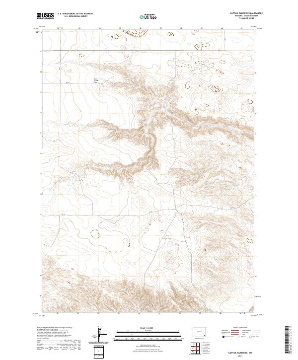
2021 Map of Cattail Ranch NE
USGS Topo · Published 2021About this map
Iowa Center Flats dominates the northern landscape of this Goshen County territory, representing a significant expanse of level terrain above the complex drainage systems to the south. The area is defined by the winding course of Fox Cr, which carves through the central and western sections of the township, creating a distinct topographical break from the surrounding plateau. This 2021 U.S. Geological Survey record illustrates a rural landscape structured by a precise grid of sectional boundaries and local access routes such as Rd 24 and Rd 16. The transition from the high flats to the eroded creek valleys provides a clear view of the hydrological patterns that have shaped land use in this part of Wyoming. Land surveyors and local historians can trace the intersection of early township divisions, including t20n r64w and t21n r65w, as they relate to the natural flow of the water and the placement of the sparse road network.
Find a feature on this map
14 named features on this map. Tap any name to fly to it.
Don’t see what you’re looking for? This feature index may not catch every label — zoom into the map to look around manually.
Map Details
Editions of this 2021 Cattail Ranch NE Map
This is the sole edition of this map. No revisions or reprints were ever made.
Other maps of this area

1899 · Goshen Hole
USGS Topo · 1:125,000

1954 · Cheyenne
USGS Topo · 1:250,000

1958 · Cheyenne
USGS Topo · 1:250,000

1960 · Diamond Flat
USGS Topo · 1:24,000

1960 · Needle Rock
USGS Topo · 1:24,000

1960 · Rocky Hollow
USGS Topo · 1:24,000

1963 · C S Ranch
USGS Topo · 1:24,000

1963 · Y B O Canyon
USGS Topo · 1:24,000
1963 · Cattail Ranch
USGS Topo · 1:24,000

1963 · Klutz Canyon
USGS Topo · 1:24,000