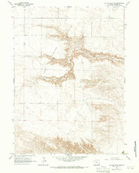
1963 Map of Cattail Ranch NE
USGS Topo · Published 1967About this map
Iowa Center Flats dominates this portion of Goshen County, representing a high plateau landscape defined by deep drainages and intermittent water sources. In the early 1960s, this area remained largely open rangeland, characterized by the sharp incisions of Fox Creek as it cuts eastward across the terrain. The small settlement of Horton stands as the primary namesake location in the southern portion of the sheet, providing a fixed point for researchers tracing family history or ranching operations in this corner of Wyoming. Scattered water resources like the named Spring highlight the critical importance of water access for the livestock and homesteads that occupied these upland flats during the mid-20th century.
Find a feature on this map
4 named features on this map. Tap any name to fly to it.
Don’t see what you’re looking for? This feature index may not catch every label — zoom into the map to look around manually.
Map Details
Editions of this 1963 Cattail Ranch NE Map
This is the sole edition of this map. No revisions or reprints were ever made.
Other maps of this area

1899 · Goshen Hole
USGS Topo · 1:125,000

1954 · Cheyenne
USGS Topo · 1:250,000

1958 · Cheyenne
USGS Topo · 1:250,000

1960 · Diamond Flat
USGS Topo · 1:24,000

1960 · Needle Rock
USGS Topo · 1:24,000

1960 · Rocky Hollow
USGS Topo · 1:24,000

1963 · C S Ranch
USGS Topo · 1:24,000

1963 · Y B O Canyon
USGS Topo · 1:24,000
1963 · Cattail Ranch
USGS Topo · 1:24,000

1963 · Klutz Canyon
USGS Topo · 1:24,000