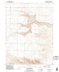
1990 Map of Cattail Ranch NE
USGS Topo · Published 1995About this map
Iowa Center Flats dominates this portion of Goshen County, revealing a landscape defined by sharp elevation shifts and drainage patterns. The topography transitions from the high, level plateau into the deeply incised valley of Fox Creek, where the terrain drops away into complex drainage systems. A notable Falls and a secluded Spring are marked within these breaks, indicating reliable water sources that would have been vital for ranching and early settlement in this part of Wyoming. The 1990 revision, based on imagery dating back to 1958, illustrates how the section lines and rural tracks respect the natural contours of the breaks while maintaining the systematic grid of the Public Land Survey System.
Find a feature on this map
4 named features on this map. Tap any name to fly to it.
Don’t see what you’re looking for? This feature index may not catch every label — zoom into the map to look around manually.
Map Details
Editions of this 1990 Cattail Ranch NE Map
This is the sole edition of this map. No revisions or reprints were ever made.
Other maps of this area

1899 · Goshen Hole
USGS Topo · 1:125,000

1954 · Cheyenne
USGS Topo · 1:250,000

1958 · Cheyenne
USGS Topo · 1:250,000

1960 · Diamond Flat
USGS Topo · 1:24,000

1960 · Needle Rock
USGS Topo · 1:24,000

1960 · Rocky Hollow
USGS Topo · 1:24,000

1963 · C S Ranch
USGS Topo · 1:24,000

1963 · Y B O Canyon
USGS Topo · 1:24,000
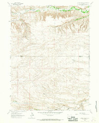
1963 · Cattail Ranch
USGS Topo · 1:24,000

1963 · Klutz Canyon
USGS Topo · 1:24,000