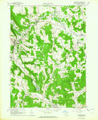
1963 Map of Cattaraugus
USGS Topo · Published 1964About this map
Cattaraugus and Otto anchor this 1963 landscape, where the Erie-Lackawanna railroad follows the valley through New Albion and Persia. The region is defined by a network of family-named heights and hollows, such as Bunkleman Hill and Skinner Hollow Road, reflecting generations of rural development. Local life centers on community landmarks like Immanuel Ch, the Central High Sch, and the Fairgrounds near Little Valley. Significant conservation areas, including the State Reforestation Area and Harry E Dobbins Memorial State Forest, cover large portions of the terrain, while Waterman Swamp and Linlyco Lake provide distinct hydrological features. The presence of numerous cemeteries like West Hill Cem and Liberty Park Cem makes this a vital resource for tracing the genealogy of the hills and valleys of western New York.
Find a feature on this map
61 named features on this map. Tap any name to fly to it.
Don’t see what you’re looking for? This feature index may not catch every label — zoom into the map to look around manually.
Map Details
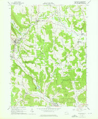
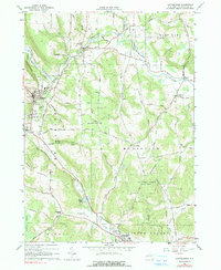
Editions of this 1963 Cattaraugus Map
3 editions found
Other maps of this area

1900 · Salamanca
USGS Topo · 1:62,500

1922 · Randolph
USGS Topo · 1:62,500

1923 · Randolph
USGS Topo · 1:62,500

1923 · Cattaraugus
USGS Topo · 1:62,500

1924 · Ellicottville
USGS Topo · 1:62,500

1938 · Cattaraugus
USGS Topo · 1:62,500

1938 · Salamanca
USGS Topo · 1:62,500

1941 · Cattaraugus
USGS Topo · 1:62,500

1941 · Ellicottville
USGS Topo · 1:62,500

1943 · Randolph
USGS Topo · 1:62,500