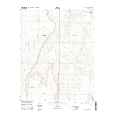
2014 Map of Cattle Canyon
USGS Topo · Published 2014About this map
Fullers Spring provides a critical water source in this arid stretch of Navajo County, situated on the edge of the Shonto Plateau. The 2014 survey documents a landscape dominated by dramatic elevation changes, where the plateau drops away into deep drainage systems like Nokai Canyon and Cattle Canyon. These geographic features are central to the region's character, with the Nokai Cr and Neskahi Wash forming the primary seasonal waterways. Transport through this high-desert terrain is facilitated by Bureau of Indian Affairs routes, specifically Bia-6310 and Bia-6450, which navigate the gaps between the high ground of Piute Mesa and Nokai Mesa. The mapping reveals a land of high plateaus and carved canyons, where name-places are often tied to these essential springs and dominant landforms.
Find a feature on this map
15 named features on this map. Tap any name to fly to it.
Don’t see what you’re looking for? This feature index may not catch every label — zoom into the map to look around manually.
Map Details
Editions of this 2014 Cattle Canyon Map
This is the sole edition of this map. No revisions or reprints were ever made.
Other maps of this area

1883 · Marsh Pass
USGS Topo · 1:250,000

1886 · Henry Mountains
USGS Topo · 1:250,000

1892 · Marsh Pass
USGS Topo · 1:250,000

1892 · Henry Mountains
USGS Topo · 1:250,000

1952 · Shato Spring 1 NE
USGS Topo · 1:24,000

1952 · Agathla Peak 2 SW
USGS Topo · 1:24,000

1952 · Agathla Peak 2 NW
USGS Topo · 1:24,000

1952 · Boot Mesa
USGS Topo · 1:62,500

1952 · Clay Hills 3 SW
USGS Topo · 1:24,000

1952 · Navajo Mtn. 4 SE
USGS Topo · 1:24,000