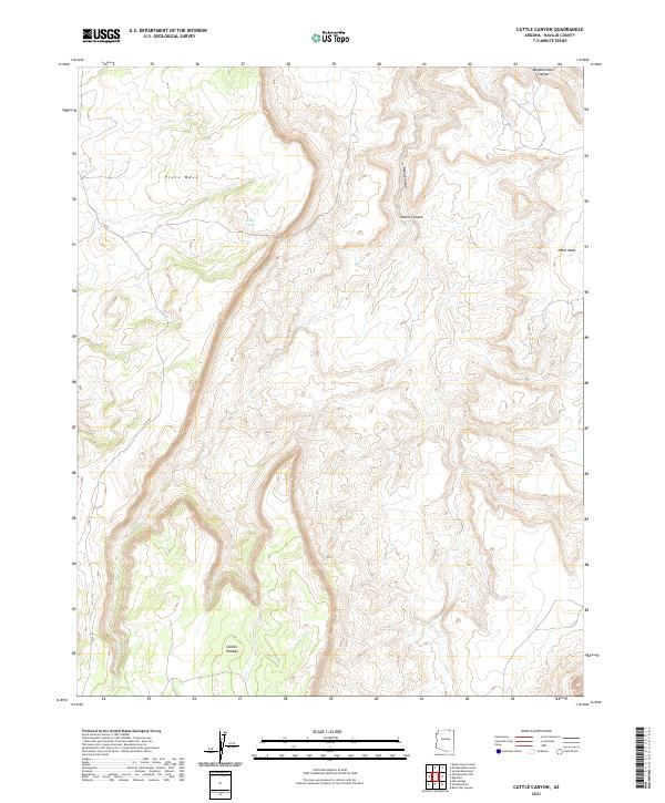
2021 Map of Cattle Canyon
USGS Topo · Published 2021About this map
Piute Mesa and Nokai Mesa dominate this high-desert landscape in northern Arizona, where deep drainages have carved into the high plateaus of the Navajo Nation. The terrain is defined by the significant elevation changes between the Shonto Plateau and the lower canyon floors, most notably within Cattle Canyon and the expansive Nokai Canyon. This 2021 survey illustrates the isolation of the region, where water sources like Fullers Spring are essential landmarks in an environment where reliable hydrology is scarce.
Find a feature on this map
12 named features on this map. Tap any name to fly to it.
Don’t see what you’re looking for? This feature index may not catch every label — zoom into the map to look around manually.
Map Details
Editions of this 2021 Cattle Canyon Map
This is the sole edition of this map. No revisions or reprints were ever made.
Other maps of this area

1883 · Marsh Pass
USGS Topo · 1:250,000

1886 · Henry Mountains
USGS Topo · 1:250,000

1892 · Marsh Pass
USGS Topo · 1:250,000

1892 · Henry Mountains
USGS Topo · 1:250,000

1952 · Shato Spring 1 NE
USGS Topo · 1:24,000

1952 · Agathla Peak 2 SW
USGS Topo · 1:24,000

1952 · Agathla Peak 2 NW
USGS Topo · 1:24,000

1952 · Boot Mesa
USGS Topo · 1:62,500

1952 · Clay Hills 3 SW
USGS Topo · 1:24,000

1952 · Navajo Mtn. 4 SE
USGS Topo · 1:24,000