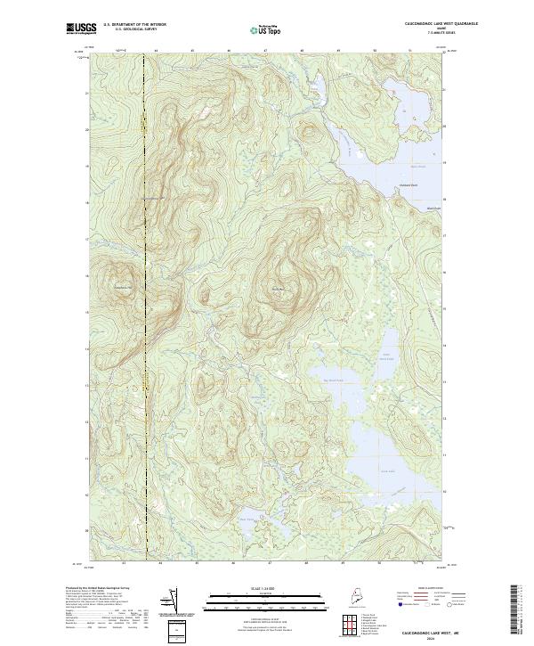
2024 Map of Caucomgomoc Lake West
USGS Topo · Published 2024About this map
The boundary between Somerset Co and Piscataquis Co bisects this northern Maine wilderness, dominated by a dense network of water bodies and high points. This 2024 data reveals a landscape defined by industrial logging access and natural drainages, where Caucomgomoc Mtn and Hurd Mtn rise above a series of glacial ponds. The drainage system is particularly evident as Caucomgomoc Stream and Loon Stream navigate the lowlands, connecting larger bodies like Loon Lake with isolated features such as McDougal Pond and Bear Brook Bog. Transportation is limited to gravel roads like Caucomgomoc Rd and NW Rd, which provide access to these remote timberlands and sporting waters. The presence of Telephone Hill and various points along the shoreline, including Hubbard Point and Black Point, suggest historical landmarks in an area otherwise dedicated to the natural flow of the North Branch Spruce Brook and Ramsell Brook systems.
Find a feature on this map
29 named features on this map. Tap any name to fly to it.
Don’t see what you’re looking for? This feature index may not catch every label — zoom into the map to look around manually.
Map Details
Editions of this 2024 Caucomgomoc Lake West Map
This is the sole edition of this map. No revisions or reprints were ever made.
Other maps of this area

1954 · Baker Lake
USGS Topo · 1:62,500

1954 · Caucomgomoc Lake
USGS Topo · 1:62,500

1954 · Allagash Lake
USGS Topo · 1:62,500

1954 · St. John Pond
USGS Topo · 1:62,500

1954 · Presque Isle
USGS Topo · 1:250,000

1958 · Presque Isle
USGS Topo · 1:250,000

1958 · Caucomgomoc Lake
USGS Topo · 1:62,500

1958 · Saint John Pond
USGS Topo · 1:62,500

1960 · Presque Isle
USGS Topo · 1:250,000

1961 · Allagash Lake
USGS Topo · 1:62,500