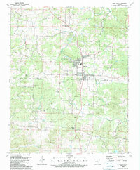
1989 Map of Cave City
USGS Topo · Published 1990About this map
Cave City serves as the central hub of this landscape, situated where the boundary of Sharp Co and Independence Co meets. The area is defined by a series of small, dispersed communities and family landmarks, such as Maxville and Hickory Valley, connected by a network of creeks like South Big Creek and Wooldridge Creek. Genealogists will find significant value in the numerous well-documented burial grounds and rural places of worship, including the Gray Chapel Cem, Palestine Ch, and the Maxville Missionary Baptist Ch. The physical terrain is punctuated by named rises like White Hill and Bray Hill, while water resources like Spring Lake and the South Fork drainage illustrate the importance of the local watershed to these small Arkansas settlements during the late 1980s.
Find a feature on this map
50 named features on this map. Tap any name to fly to it.
Don’t see what you’re looking for? This feature index may not catch every label — zoom into the map to look around manually.
Map Details
Editions of this 1989 Cave City Map
This is the sole edition of this map. No revisions or reprints were ever made.
Other maps of this area

1890 · Batesville
USGS Topo · 1:125,000

1891 · Batesville
USGS Topo · 1:125,000

1932 · Strawberry
USGS Topo · 1:62,500

1935 · Strawberry
USGS Topo · 1:62,500

1941 · Strawberry
USGS Topo · 1:62,500

1942 · Batesville
USGS Topo · 1:31,680

1943 · Sandtown
USGS Topo · 1:24,000

1943 · Cave City
USGS Topo · 1:31,680

1943 · Sulphur Rock
USGS Topo · 1:31,680

1943 · Batesville
USGS Topo · 1:24,000