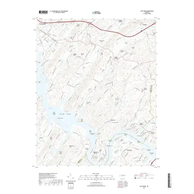
2019 Map of Cave Creek
USGS Topo · Published 2019About this map
Kingston and Loudon anchor the northern and southern margins of this study, which follows the winding course of the Tennessee River as it forms the boundary between Roane and Loudon Counties. The landscape is defined by the significant reaches of Watts Bar Lake, where landmarks like Huffine Island and the Seven Islands Shoals sit in the main channel. Smaller settlements such as Poplar Springs, New Midway, and Dogwood occupy the interior valleys between ridges like Copper Ridge and Chestnut Ridge. The map is particularly useful for genealogical research, documenting numerous family cemeteries including Love Cem, Ladd Cem, and the Zwicker Cem. Notable aviation infrastructure is present at the Wolf Creek Airport, while the northern portion shows the development around Rose Bailey Lake and Kingston Memorial Gardens.
Find a feature on this map
188 named features on this map. Tap any name to fly to it.
Don’t see what you’re looking for? This feature index may not catch every label — zoom into the map to look around manually.
Map Details
Editions of this 2019 Cave Creek Map
This is the sole edition of this map. No revisions or reprints were ever made.
Other maps of this area

1887 · Kingston
USGS Topo · 1:125,000

1891 · Kingston
USGS Topo · 1:125,000

1893 · Kingston
USGS Topo · 1:125,000

1895 · Loudon
USGS Topo · 1:125,000

1935 · Lenoir City
USGS Topo · 1:24,000

1935 · Elverton
USGS Topo · 1:24,000

1935 · Bethel Valley
USGS Topo · 1:24,000

1935 · Harriman
USGS Topo · 1:24,000

1935 · Philadelphia
USGS Topo · 1:24,000

1936 · Cave Creek
USGS Topo · 1:24,000