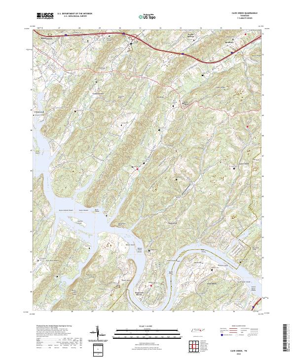
2022 Map of Cave Creek
USGS Topo · Published 2022About this map
The Tennessee River and Watts Bar Lake dominate the southern half of this landscape, carving through a series of parallel ridges and valleys including Johnston Valley, Bradbury Valley, and Greasy Run Valley. The terrain is defined by prominent elevations such as Copper Ridge, Chestnut Ridge, and Paint Rock Ridge, which funnel local travel along established corridors like the Broadway of America. In the northern section, the intersection of I-40 and I-75 near Kingston marks a modern transportation hub, yet the map preserves numerous sites of genealogical interest.
Find a feature on this map
194 named features on this map. Tap any name to fly to it.
Don’t see what you’re looking for? This feature index may not catch every label — zoom into the map to look around manually.
Map Details
Editions of this 2022 Cave Creek Map
This is the sole edition of this map. No revisions or reprints were ever made.
Other maps of this area

1887 · Kingston
USGS Topo · 1:125,000

1891 · Kingston
USGS Topo · 1:125,000

1893 · Kingston
USGS Topo · 1:125,000

1895 · Loudon
USGS Topo · 1:125,000

1935 · Lenoir City
USGS Topo · 1:24,000

1935 · Elverton
USGS Topo · 1:24,000

1935 · Bethel Valley
USGS Topo · 1:24,000

1935 · Harriman
USGS Topo · 1:24,000

1935 · Philadelphia
USGS Topo · 1:24,000

1936 · Cave Creek
USGS Topo · 1:24,000