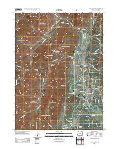
2011 Map of Cave Junction
USGS Topo · Published 2011About this map
Cave Junction and the neighboring settlement of Kerby anchor this portion of the Illinois Valley, where the Illinois River and its East Fork converge. The landscape is defined by the transition from the valley floor to the prominent heights of Woodcock Mountain and Tennessee Mountain. Local infrastructure, including the Kerby Post Office and the Cave Junction Post Office, indicates the continued importance of these established communities. Water management is evident through features like Pomeroy Dam, Kerby Ditch, and the Rosenberg Reservoir at the southern edge. The map also documents numerous gulches and creeks, such as Tennessee Gulch and Choke Cherry Creek, alongside historical local sites like Laurel Cemetery.
Find a feature on this map
82 named features on this map. Tap any name to fly to it.
Don’t see what you’re looking for? This feature index may not catch every label — zoom into the map to look around manually.
Map Details
Editions of this 2011 Cave Junction Map
This is the sole edition of this map. No revisions or reprints were ever made.
Other maps of this area

1917 · Kerby
USGS Topo · 1:125,000

1918 · Kerby
USGS Topo · 1:125,000

1945 · Kerby
USGS Topo · 1:125,000

1954 · Cave Junction
USGS Topo · 1:62,500

1954 · Selma
USGS Topo · 1:62,500

1954 · Chetco Peak
USGS Topo · 1:62,500

1954 · Pearsoll Peak
USGS Topo · 1:62,500

1955 · Medford
USGS Topo · 1:250,000

1957 · Medford
USGS Topo · 1:250,000

1958 · Medford
USGS Topo · 1:250,000