
1954 Map of Chetco Peak
USGS Topo · Published 1956About this map
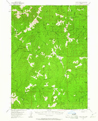
Siskiyou National Forest dominates this mid-1950s terrain, revealing a landscape defined by its remote outposts and the Chetco River watershed. The map documents a network of isolated structures, including Madstone Cabin, Bailey Cabin, and Emily Cabin, which likely served as seasonal shelters for forest rangers or miners. High points like Chetco Peak and Vulcan Peak provide the topography for fire management, indicated by the Chetco Lookout and the VABM McGrew Cleopatra Lookout further south. The boundary between Curry and Josephine counties follows the high ridgelines, while Cottonwood Camp and Sourdough Camp suggest established stopovers for those navigating the backcountry. This era represents a time when accessibility was limited to specialized stations like Bain Station and rugged forest trails before modern road development.
Find a feature on this map
76 named features on this map. Tap any name to fly to it.
Don’t see what you’re looking for? This feature index may not catch every label — zoom into the map to look around manually.
Map Details
Editions of this 1954 Chetco Peak Map
4 editions found
Other maps of this area

1917 · Kerby
USGS Topo · 1:125,000

1918 · Kerby
USGS Topo · 1:125,000

1922 · Preston Peak
USGS Topo · 1:125,000

1929 · Crescent City
USGS Topo · 1:125,000

1945 · Kerby
USGS Topo · 1:125,000

1945 · Gasquet
USGS Topo · 1:62,500

1945 · Point St. George
USGS Topo · 1:62,500

1948 · Weed
USGS Topo · 1:250,000

1949 · Eureka
USGS Topo · 1:250,000

1950 · Weed
USGS Topo · 1:250,000