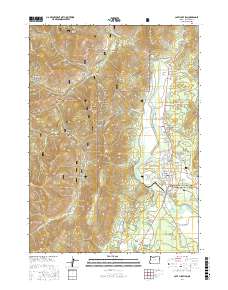
2017 Map of Cave Junction
USGS Topo · Published 2017About this map
The Illinois River valley serves as the primary artery of development in this Josephine County survey, where the settlements of Cave Junction and Kerby follow the north-south corridor of the highway. The landscape transitions sharply from the agricultural and residential flats of the river basin to the steep, wooded reaches of the Siskiyou National Forest. Numerous small drainages like Free and Easy Cr and Nogle Cr feed into the main river system, supporting local water management features such as the Kerby Ditch and the Rosenberg Reservoir. To the west, the terrain rises into prominent summits including Tennessee Mtn and Woodcock Mtn, while the eastern portion includes a segment of the Oregon Caves National Monument and Preserve. Evidence of local history and genealogy can be found at the Laurel Cem and across named localities like Sauers Flat.
Find a feature on this map
79 named features on this map. Tap any name to fly to it.
Don’t see what you’re looking for? This feature index may not catch every label — zoom into the map to look around manually.
Map Details
Editions of this 2017 Cave Junction Map
This is the sole edition of this map. No revisions or reprints were ever made.
Other maps of this area

1917 · Kerby
USGS Topo · 1:125,000

1918 · Kerby
USGS Topo · 1:125,000

1945 · Kerby
USGS Topo · 1:125,000

1954 · Cave Junction
USGS Topo · 1:62,500

1954 · Selma
USGS Topo · 1:62,500

1954 · Chetco Peak
USGS Topo · 1:62,500

1954 · Pearsoll Peak
USGS Topo · 1:62,500

1955 · Medford
USGS Topo · 1:250,000

1957 · Medford
USGS Topo · 1:250,000

1958 · Medford
USGS Topo · 1:250,000