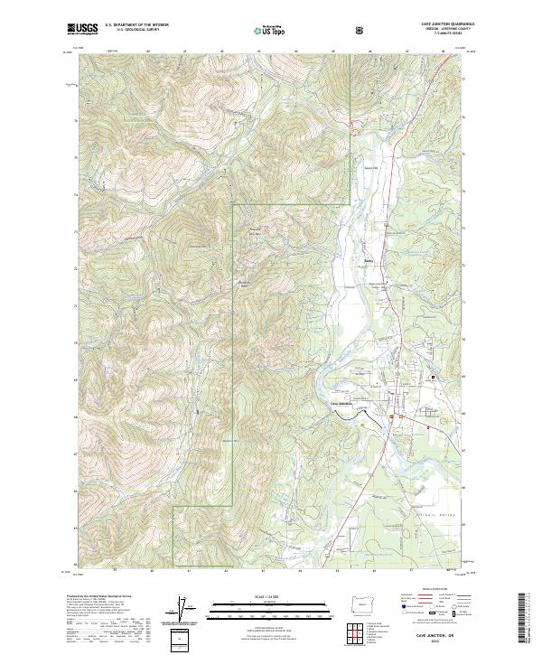
2023 Map of Cave Junction
USGS Topo · Published 2023About this map
The Illinois River flows through this Josephine County landscape, carved by a network of gulches and creeks such as Josephine Creek and Tennessee Gulch. Centered on the communities of Cave Junction and Kerby, the map illustrates a region where local life and public lands intersect at the gateway to the Oregon Caves National Monument and Preserve. The settlement pattern follows the river valley and its tributaries, with residential roads branching out toward Sauers Flat and the foothills of Tennessee Mtn.
Find a feature on this map
76 named features on this map. Tap any name to fly to it.
Don’t see what you’re looking for? This feature index may not catch every label — zoom into the map to look around manually.
Map Details
Editions of this 2023 Cave Junction Map
This is the sole edition of this map. No revisions or reprints were ever made.
Other maps of this area

1917 · Kerby
USGS Topo · 1:125,000

1918 · Kerby
USGS Topo · 1:125,000

1945 · Kerby
USGS Topo · 1:125,000

1954 · Cave Junction
USGS Topo · 1:62,500

1954 · Selma
USGS Topo · 1:62,500

1954 · Chetco Peak
USGS Topo · 1:62,500

1954 · Pearsoll Peak
USGS Topo · 1:62,500

1955 · Medford
USGS Topo · 1:250,000

1957 · Medford
USGS Topo · 1:250,000

1958 · Medford
USGS Topo · 1:250,000