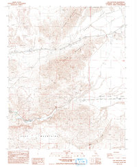
1986 Map of Cave Mountain
USGS Topo · Published 1993About this map
The Mojave River Wash defines the heart of this high-desert landscape in the mid-1980s, carving a wide path between the prominent peaks of Cave Mountain and the Cady Mountains. This provisional survey records the sparse industrial and transit infrastructure of the region, including a prominent Transmission Line and Pipeline that traverse the arid terrain. Traces of human activity are scattered throughout, marked by numerous Prospects, Mine sites, and several Gravel Pit operations.
Find a feature on this map
21 named features on this map. Tap any name to fly to it.
Don’t see what you’re looking for? This feature index may not catch every label — zoom into the map to look around manually.
Map Details
Editions of this 1986 Cave Mountain Map
2 editions found
Other maps of this area

1933 · Avawatz Mountains
USGS Topo · 1:250,000

1947 · Trona
USGS Topo · 1:250,000

1948 · Trona
USGS Topo · 1:250,000

1948 · Cave Mountain
USGS Topo · 1:62,500

1951 · Cave Mountain
USGS Topo · 1:62,500

1953 · San Bernardino
USGS Topo · 1:250,000

1953 · Trona
USGS Topo · 1:250,000

1955 · Cady Mountains
USGS Topo · 1:62,500

1955 · Broadwell Lake
USGS Topo · 1:62,500

1956 · San Bernardino
USGS Topo · 1:250,000