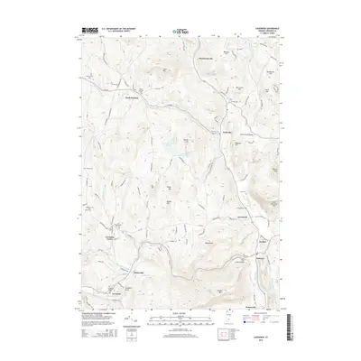
2015 Map of Cavendish
USGS Topo · Published 2015About this map
The Black River winds through the heart of Windsor County, carving the dramatic Cavendish Gorge and anchoring a series of historic village centers. This 2015 study of the Vermont landscape reveals a dense network of early settlement sites and burial grounds, such as the Old Revolutionary War Cem near Cavendish Center and the Sawyer-Stand Cem to the northwest. The terrain is defined by prominent peaks including Hawks Mtn and Little Ascutney Mtn, while the valley floors are connected by timber spans like Bests Covered Bridge over Mill Brook. The local economy of the past is still visible in the distribution of hamlets like South Reading, Felchville, and Amsden, many of which developed around water power and agricultural crossroads. From the Knapp Brook Ponds to the Twentymile Stream confluence at Whitesville, the map documents a region where modern infrastructure follows long-established transit corridors along the riverbanks.
Find a feature on this map
117 named features on this map. Tap any name to fly to it.
Don’t see what you’re looking for? This feature index may not catch every label — zoom into the map to look around manually.
Map Details
Editions of this 2015 Cavendish Map
This is the sole edition of this map. No revisions or reprints were ever made.
Other maps of this area

1906 · Hanover
USGS Topo · 1:62,500

1908 · Hanover
USGS Topo · 1:62,500

1911 · Woodstock
USGS Topo · 1:62,500

1913 · Woodstock
USGS Topo · 1:62,500

1926 · Claremont
USGS Topo · 1:62,500

1928 · Ludlow
USGS Topo · 1:48,000

1929 · Claremont
USGS Topo · 1:62,500

1929 · Ludlow
USGS Topo · 1:62,500

1932 · Ludlow
USGS Topo · 1:62,500

1943 · Woodstock
USGS Topo · 1:62,500