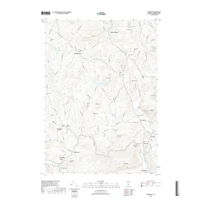
2018 Map of Cavendish
USGS Topo · Published 2018About this map
Cavendish Gorge and the winding course of the Black River anchor this landscape in Windsor County, Vermont. The terrain is defined by numerous named peaks, including Hawks Mtn and Little Ascutney Mtn, which frame a network of small settlements and rural hamlets like South Reading, Hammondsville, and Amsden. This area is particularly dense with sites of interest for genealogists, featuring many burial grounds such as the Old Revolutionary War Cem and Mount Union Cem near Cavendish Center. The map also highlights local engineering landmarks, notably Bests Covered Bridge and Upper Falls Covered Bridge, which span the river valleys. The intricate road system, from Tyson Rd to S Ruckerbrush Rd, reveals a settlement pattern dictated by the steep elevations of Keyes Mtn and Widow Hill.
Find a feature on this map
110 named features on this map. Tap any name to fly to it.
Don’t see what you’re looking for? This feature index may not catch every label — zoom into the map to look around manually.
Map Details
Editions of this 2018 Cavendish Map
This is the sole edition of this map. No revisions or reprints were ever made.
Other maps of this area

1906 · Hanover
USGS Topo · 1:62,500

1908 · Hanover
USGS Topo · 1:62,500

1911 · Woodstock
USGS Topo · 1:62,500

1913 · Woodstock
USGS Topo · 1:62,500

1926 · Claremont
USGS Topo · 1:62,500

1928 · Ludlow
USGS Topo · 1:48,000

1929 · Claremont
USGS Topo · 1:62,500

1929 · Ludlow
USGS Topo · 1:62,500

1932 · Ludlow
USGS Topo · 1:62,500

1943 · Woodstock
USGS Topo · 1:62,500