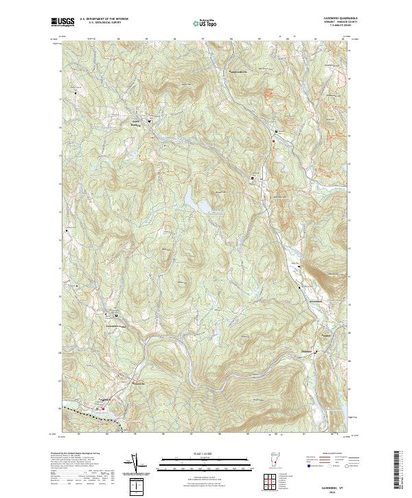
2024 Map of Cavendish
USGS Topo · Published 2024About this map
Cavendish and the Black River valley serve as the focal point for this Vermont landscape, where the river's path has long shaped local industry and settlement. The map highlights the town's burial grounds, including the Old Revolutionary War Cem and Cavendish Village Cem, providing essential markers for genealogical research in Windsor County. To the north, South Reading and Hammondsville sit among the uplands of Keyes Mtn and Wardner Hill, connected by a network of rural routes like Tyson Rd and Matthews Dr. The terrain is defined by dramatic elevation changes, most notably at Cavendish Gorge and the heights of Hawks Mtn. Small clusters of homes and historical sites appear at Amsden, Downers, and Greenbush, while the North Branch Black River feeds into Stoughton Pond, illustrating the persistent relationship between the area's water resources and its topographic character.
Find a feature on this map
113 named features on this map. Tap any name to fly to it.
Don’t see what you’re looking for? This feature index may not catch every label — zoom into the map to look around manually.
Map Details
Editions of this 2024 Cavendish Map
This is the sole edition of this map. No revisions or reprints were ever made.
Other maps of this area

1906 · Hanover
USGS Topo · 1:62,500

1908 · Hanover
USGS Topo · 1:62,500

1911 · Woodstock
USGS Topo · 1:62,500

1913 · Woodstock
USGS Topo · 1:62,500

1926 · Claremont
USGS Topo · 1:62,500

1928 · Ludlow
USGS Topo · 1:48,000

1929 · Claremont
USGS Topo · 1:62,500

1929 · Ludlow
USGS Topo · 1:62,500

1932 · Ludlow
USGS Topo · 1:62,500

1943 · Woodstock
USGS Topo · 1:62,500