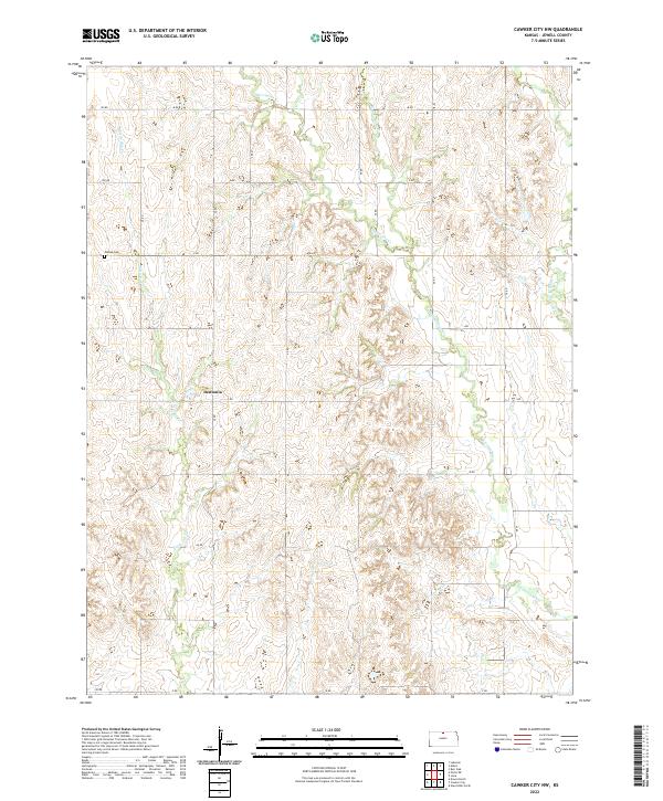
2022 Map of Cawker City NW
USGS Topo · Published 2022About this map
Dentonia serves as the central settlement in this portion of Jewell County, where the high plains are deeply dissected by a network of seasonal watercourses. The landscape is defined by the headwaters and drainages of Porcupine Cr and W Limestone Cr, which carve through the agricultural tablelands. The grid-like road system, including K RD and M RD, reflects the systematic land divisions typical of the region's homesteading history. Near the western edge of the map, the Odessa Cem stands as a quiet marker of early community life and genealogy. The terrain is marked by the branching fingers of Little Oak Cr and Middle Limestone Cr, which dictate the local topography and the placement of rural homesteads across the townships.
Find a feature on this map
21 named features on this map. Tap any name to fly to it.
Don’t see what you’re looking for? This feature index may not catch every label — zoom into the map to look around manually.
Map Details
Editions of this 2022 Cawker City NW Map
This is the sole edition of this map. No revisions or reprints were ever made.
Other maps of this area

1893 · Smith Center
USGS Topo · 1:125,000

1894 · Mankato
USGS Topo · 1:125,000

1955 · Beloit
USGS Topo · 1:250,000

1959 · Beloit
USGS Topo · 1:250,000

1960 · Downs North
USGS Topo · 1:24,000

1962 · Cawker City
USGS Topo · 1:24,000

1962 · Glen Elder North
USGS Topo · 1:24,000

1968 · Burr Oak
USGS Topo · 1:24,000
1969 · Ionia
USGS Topo · 1:24,000
1969 · Cawker City NW
USGS Topo · 1:24,000