
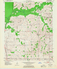
1951 Map of Cayce
USGS Topo · Published 1952About this map
Cayce and its surrounding agricultural lands are defined by a network of bayous and rail lines crossing the Kentucky-Tennessee border in the early 1950s. The settlement landscape is anchored by rural congregations and burial grounds, including Alexander Cem and several churches such as Harmony Ch and Rush Creek Ch. The presence of the Gulf Mobile and Ohio and the Nashville Chattanooga and St Louis railroads indicates the importance of these transport corridors for moving goods through the Fulton and Obion county line region. The low-lying terrain is marked by distinctive water features like Bayou du Chien, Halfmoon Pond, and David Pond, illustrating the complex drainage of the area before modern landscape modifications. Small communities like Moscow, Jordan, and State Line serve as local hubs in this borderland economy.
Find a feature on this map
24 named features on this map. Tap any name to fly to it.
Don’t see what you’re looking for? This feature index may not catch every label — zoom into the map to look around manually.
Map Details
Editions of this 1951 Cayce Map
2 editions found
Other maps of this area

1939 · Hickman
USGS Topo · 1:62,500

1951 · Oakton
USGS Topo · 1:24,000

1951 · Hickman
USGS Topo · 1:24,000

1951 · Wolf Island
USGS Topo · 1:24,000

1952 · Clinton
USGS Topo · 1:24,000

1952 · Crutchfield
USGS Topo · 1:24,000

1952 · Water Valley
USGS Topo · 1:62,500

1954 · Union City
USGS Topo · 1:24,000

1954 · Hickman
USGS Topo · 1:62,500
1955 · Hickman
USGS Topo · 1:62,500