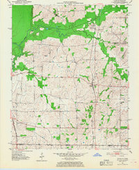
1951 Map of Cayce
USGS Topo · Published 1968About this map
The Gulf Mobile and Ohio railroad corridor anchors this 1950s study of the Kentucky-Tennessee borderlands, connecting the small rail settlements of Cayce, Moscow, and Jordan. The landscape is defined by the meandering drainage systems of Little Bayou du Chien and Mud Creek, where small local impoundments like Cornwall Pond and Halfmoon Pond dot the low-lying terrain.
Find a feature on this map
22 named features on this map. Tap any name to fly to it.
Don’t see what you’re looking for? This feature index may not catch every label — zoom into the map to look around manually.
Map Details
Editions of this 1951 Cayce Map
2 editions found
Other maps of this area

1939 · Hickman
USGS Topo · 1:62,500

1951 · Cayce
USGS Topo · 1:24,000

1951 · Oakton
USGS Topo · 1:24,000

1951 · Hickman
USGS Topo · 1:24,000

1951 · Wolf Island
USGS Topo · 1:24,000

1952 · Clinton
USGS Topo · 1:24,000

1952 · Crutchfield
USGS Topo · 1:24,000

1952 · Water Valley
USGS Topo · 1:62,500

1954 · Union City
USGS Topo · 1:24,000

1954 · Hickman
USGS Topo · 1:62,500