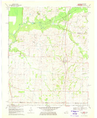
1970 Map of Cayce
USGS Topo · Published 1972About this map
Cayce and Moscow anchor this West Kentucky landscape as it appeared in 1970, situated along the Gulf Mobile and Ohio railroad line. This survey captures a rural environment defined by the meandering course of Bayou de Chien and its various wetland features, such as Halfmoon Pond and Cornwall Pond. The map provides significant genealogical value, documenting numerous family-named landmarks and cemeteries including Roper Cem, McGee Cem, and Bacon Cem. The southern edge of the sheet documents the Kentucky Tennessee border, showing the proximity of Woodland Mills and Jordan to the State Line. Settlement patterns follow the elevated ground between drainage systems like Samson Creek and Rush Creek, with local social centers marked by country churches such as Rush Creek Ch and Mt Hermon Ch.
Find a feature on this map
27 named features on this map. Tap any name to fly to it.
Don’t see what you’re looking for? This feature index may not catch every label — zoom into the map to look around manually.
Map Details
Editions of this 1970 Cayce Map
2 editions found
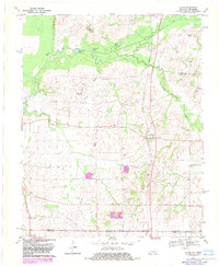
Other maps of this area

1939 · Hickman
USGS Topo · 1:62,500

1951 · Cayce
USGS Topo · 1:24,000

1951 · Oakton
USGS Topo · 1:24,000

1951 · Hickman
USGS Topo · 1:24,000

1951 · Wolf Island
USGS Topo · 1:24,000

1952 · Clinton
USGS Topo · 1:24,000

1952 · Crutchfield
USGS Topo · 1:24,000

1952 · Water Valley
USGS Topo · 1:62,500

1954 · Union City
USGS Topo · 1:24,000

1954 · Hickman
USGS Topo · 1:62,500