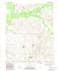
1970 Map of Cayce
USGS Topo · Published 1983About this map
Cayce and the surrounding farmland of Fulton County characterize this rural landscape during the transition from the late 1960s into the early 1980s. The terrain is defined by the winding course of Bayou de Chien, which meanders through the northern section past Halfmoon Pond and Cornwall Pond. Small, family-centered landmarks such as Roper Cem and McGee Cem are scattered throughout the low-lying hills, alongside country churches like Rush Creek Ch and Harmony Ch. The map illustrates the interstate boundary between Kentucky and Tennessee, where the settlement of State Line and the village of Woodland Mills sit just south of the border. This survey is particularly useful for genealogists, as it preserves the exact locations of numerous community hubs and family cemeteries that served the local agricultural population before more modern development patterns took hold.
Find a feature on this map
26 named features on this map. Tap any name to fly to it.
Don’t see what you’re looking for? This feature index may not catch every label — zoom into the map to look around manually.
Map Details
Editions of this 1970 Cayce Map
2 editions found
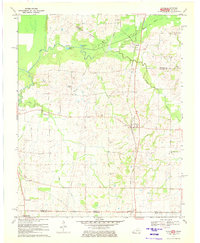
Other maps of this area

1939 · Hickman
USGS Topo · 1:62,500

1951 · Cayce
USGS Topo · 1:24,000

1951 · Oakton
USGS Topo · 1:24,000

1951 · Hickman
USGS Topo · 1:24,000

1951 · Wolf Island
USGS Topo · 1:24,000

1952 · Clinton
USGS Topo · 1:24,000

1952 · Crutchfield
USGS Topo · 1:24,000

1952 · Water Valley
USGS Topo · 1:62,500

1954 · Union City
USGS Topo · 1:24,000

1954 · Hickman
USGS Topo · 1:62,500