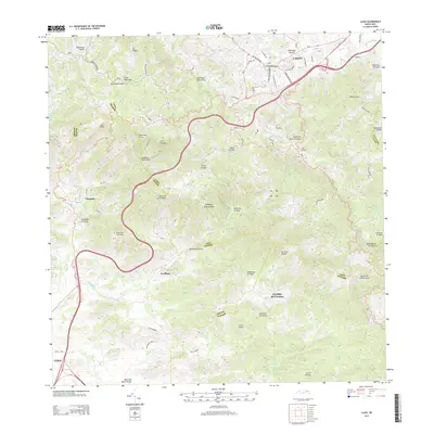
2013 Map of Cayey
USGS Topo · Published 2013About this map
Cayey serves as a central hub in the mountain landscape of Puerto Rico, where the dense street grid including Calle Luis Muñoz Rivera and Ave Jose De Diego W meets a network of vital waterways like Río de la Plata and Quebrada Morillo. The terrain is characterized by prominent peaks such as the twin peaks of Las Tetas and the high ridges of Sierra de Jájome.
Find a feature on this map
63 named features on this map. Tap any name to fly to it.
Don’t see what you’re looking for? This feature index may not catch every label — zoom into the map to look around manually.
Map Details
Editions of this 2013 Cayey Map
This is the sole edition of this map. No revisions or reprints were ever made.
Other maps of this area

1945 · Central Aguirre
USGS Topo · 1:30,000

1945 · Salinas
USGS Topo · 1:30,000

1946 · Patillas
USGS Topo · 1:30,000

1946 · Coamo
USGS Topo · 1:30,000

1946 · Barranquitas
USGS Topo · 1:30,000

1946 · Cayey
USGS Topo · 1:30,000

1946 · Comerio
USGS Topo · 1:30,000

1946 · Guayama
USGS Topo · 1:30,000

1946 · Caguas
USGS Topo · 1:30,000

1947 · Cayey NO
USGS Topo · 1:10,000
Featured Places
- Cayey
- Sector Los Paganes, Cayey
- Alturas de Cantera, Cayey
- Sector La Sierra, Aibonito
- Sector El Campito, Cayey