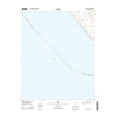
2015 Map of Cayucos OE W
USGS Topo · Published 2015About this map
The Pacific Ocean dominates this coastal survey, where the central California shoreline meets the steep terrain of San Luis Obispo Co. In the northeastern corner, the landscape rises sharply into the coastal hills, defined by the t28s r9e township survey. The drainage of Ellysly Cr cuts through these contours as it descends toward the sea, representing one of the few named terrestrial features on this predominantly maritime sheet. The map illustrates the interface between the open ocean and the rugged, mostly undeveloped shoreline of the central coast during the early twenty-first century.
Find a feature on this map
5 named features on this map. Tap any name to fly to it.
Don’t see what you’re looking for? This feature index may not catch every label — zoom into the map to look around manually.
Map Details
Editions of this 2015 Cayucos OE W Map
This is the sole edition of this map. No revisions or reprints were ever made.
Other maps of this area

1897 · Cayucos
USGS Topo · 1:62,500

1900 · San Luis
USGS Topo · 1:125,000

1919 · Adelaida
USGS Topo · 1:62,500

1919 · San Simeon
USGS Topo · 1:62,500

1932 · Adelaida
USGS Topo · 1:62,500

1937 · Cayucos
USGS Topo · 1:62,500

1937 · San Simeon
USGS Topo · 1:62,500

1942 · Adelaida
USGS Topo · 1:62,500

1943 · Cayucos
USGS Topo · 1:62,500

1947 · San Luis Obispo
USGS Topo · 1:250,000