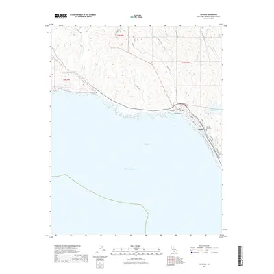
2018 Map of Cayucos
USGS Topo · Published 2018About this map
Cayucos sits along the curve of Estero Bay, where the coastal hills of San Luis Obispo County meet the Pacific Ocean. This 2018 survey shows a landscape defined by the intersection of residential growth and long-standing agricultural boundaries, with township lines like t28s r10e and t28s r9e dividing the interior ranch lands. The drainage network is complex, featuring coastal streams such as Villa Creek, Cayucos Creek, and Little Cayucos Creek that flow from the steep ridges toward the shoreline.
Find a feature on this map
36 named features on this map. Tap any name to fly to it.
Don’t see what you’re looking for? This feature index may not catch every label — zoom into the map to look around manually.
Map Details
Editions of this 2018 Cayucos Map
This is the sole edition of this map. No revisions or reprints were ever made.
Other maps of this area

1897 · Cayucos
USGS Topo · 1:62,500

1900 · San Luis
USGS Topo · 1:125,000

1919 · Adelaida
USGS Topo · 1:62,500

1919 · San Simeon
USGS Topo · 1:62,500

1932 · Adelaida
USGS Topo · 1:62,500

1937 · Cayucos
USGS Topo · 1:62,500

1937 · San Simeon
USGS Topo · 1:62,500

1942 · Adelaida
USGS Topo · 1:62,500

1943 · Cayucos
USGS Topo · 1:62,500

1947 · San Luis Obispo
USGS Topo · 1:250,000