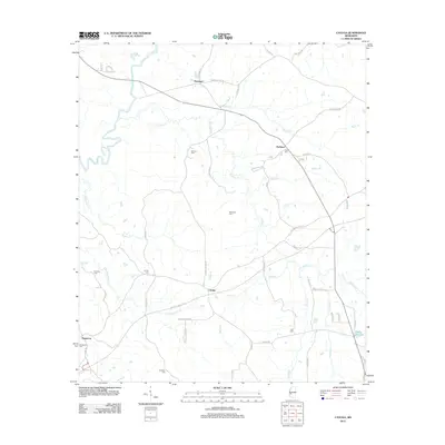
2012 Map of Cayuga
USGS Topo · Published 2012About this map
The Big Black River snakes along the western edge of this Hinds and Claiborne County landscape, defining the rugged hydrology of the region. This 2012 survey highlights the rural community of Cayuga, situated at a traditional crossroads where Cayuga Rd meets Charlie Brown Rd. The map is particularly valuable for genealogical research, identifying numerous family and community burial grounds such as Belmont Cem, McElwee Cem, and Cook Cem. Transport through the area is anchored by the historic corridor of the Natchez Trace Pkwy, which bypasses the older settlements of Reganton and Hubbard. The terrain is deeply incised by numerous waterways like Fivemile Cr and Commissioners Cr, which shaped the early agricultural development and settlement patterns seen here.
Find a feature on this map
58 named features on this map. Tap any name to fly to it.
Don’t see what you’re looking for? This feature index may not catch every label — zoom into the map to look around manually.
Map Details
Editions of this 2012 Cayuga Map
This is the sole edition of this map. No revisions or reprints were ever made.
Other maps of this area

1918 · Vicksburg
USGS Topo · 1:62,500

1938 · Edwards
USGS Topo · 1:62,500

1939 · Yokena
USGS Topo · 1:62,500

1941 · Vicksburg
USGS Topo · 1:62,500

1955 · Jackson
USGS Topo · 1:250,000

1961 · Jackson
USGS Topo · 1:250,000

1962 · Jackson
USGS Topo · 1:250,000

1962 · Vicksburg East
USGS Topo · 1:24,000

1962 · Utica West
USGS Topo · 1:24,000

1963 · Carlisle
USGS Topo · 1:24,000