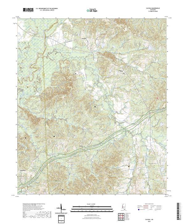
2024 Map of Cayuga
USGS Topo · Published 2024About this map
Cayuga and its surrounding countryside in Hinds and Warren counties are bisected by the Natchez Trace Parkway, which follows the ancient travel corridor through this part of Mississippi. The landscape is defined by the winding course of the Big Black River, marking the boundary between Hinds and Warren counties, and a dense network of smaller drainages like Commissioners Creek and Maxie Creek. Historically, this area relied on river crossings and established post roads, evidenced by the crossing at Baldwins Ferry and the Old Port Gibson Rd. For local historians and genealogists, the map is remarkably dense with family-named burial grounds, including Belmont Cem, McElwee Cem, and Hutchins Cem, scattered among small settlements such as Hubbard and Newman. The proximity of these cemeteries to rural roads like Cayuga Rd and Newman Rd suggests a pattern of long-standing family landholdings in this pocket of the state.
Find a feature on this map
64 named features on this map. Tap any name to fly to it.
Don’t see what you’re looking for? This feature index may not catch every label — zoom into the map to look around manually.
Map Details
Editions of this 2024 Cayuga Map
This is the sole edition of this map. No revisions or reprints were ever made.
Other maps of this area

1918 · Vicksburg
USGS Topo · 1:62,500

1938 · Edwards
USGS Topo · 1:62,500

1939 · Yokena
USGS Topo · 1:62,500

1941 · Vicksburg
USGS Topo · 1:62,500

1955 · Jackson
USGS Topo · 1:250,000

1961 · Jackson
USGS Topo · 1:250,000

1962 · Jackson
USGS Topo · 1:250,000

1962 · Vicksburg East
USGS Topo · 1:24,000

1962 · Utica West
USGS Topo · 1:24,000

1963 · Carlisle
USGS Topo · 1:24,000