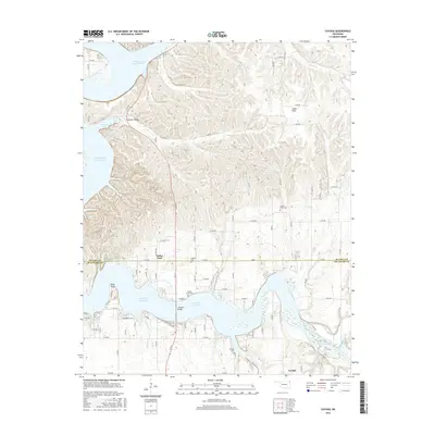
2016 Map of Cayuga
USGS Topo · Published 2016About this map
Cayuga and Turkey Ford serve as primary anchors in this landscape along the border of Ottawa and Delaware counties. The shoreline of Grand Lake O' the Cherokees and Lake O the Cherokees defines the southwestern terrain, with the Cowskin Bridge crossing a central arm of the water. This region is marked by significant local history sites, including Council Hollow and several family or community burial grounds such as Council House Cem and Bassett Grove Cem. The map illustrates a rural network where small settlements are connected by local routes like Cayuga Rd and Rd 240, weaving through landforms such as Fisher Flats and Wolf Point. To the east, the waters of Buffalo Creek and Elk River join the larger lake system, while the northern reaches include the winding path of Brush Cr near the county line.
Find a feature on this map
83 named features on this map. Tap any name to fly to it.
Don’t see what you’re looking for? This feature index may not catch every label — zoom into the map to look around manually.
Map Details
Editions of this 2016 Cayuga Map
This is the sole edition of this map. No revisions or reprints were ever made.
Other maps of this area

1907 · Wyandotte
USGS Topo · 1:125,000

1909 · Wyandotte
USGS Topo · 1:125,000

1949 · Seneca
USGS Topo · 1:24,000

1950 · Seneca
USGS Topo · 1:24,000

1954 · Tulsa
USGS Topo · 1:250,000

1958 · Tulsa
USGS Topo · 1:250,000

1961 · Miami SE
USGS Topo · 1:24,000

1961 · Wyandotte
USGS Topo · 1:24,000

1963 · Tulsa
USGS Topo · 1:250,000
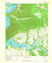
1964 · Cayuga
USGS Topo · 1:24,000