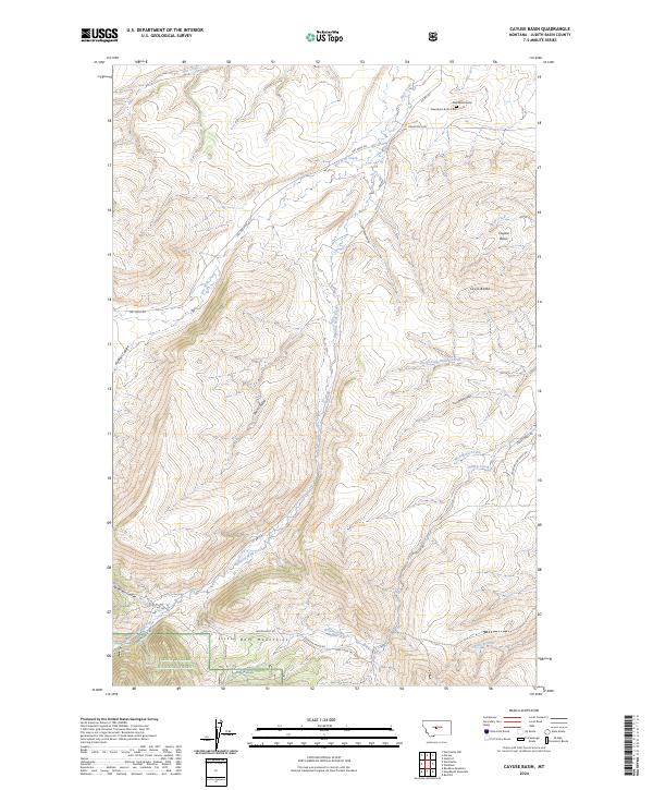
2024 Map of Cayuse Basin
USGS Topo · Published 2024About this map
The Little Belt Mountains define the southern landscape of this Judith Basin County quadrangle, where the rugged slopes of the Lewis & Clark National Forest transition into a complex system of coulees and ridges. Higher elevations are marked by the presence of an Iron Mine and the distinctive silhouettes of Steamboat Butte and Skull Butte. These landmarks oversaw a network of 19th-century transit routes including Stagecoach Rd and Dry Wolf Rd, which trace the drainage patterns of Dry Wolf Creek and its many tributaries.
Find a feature on this map
37 named features on this map. Tap any name to fly to it.
Don’t see what you’re looking for? This feature index may not catch every label — zoom into the map to look around manually.
Map Details
Editions of this 2024 Cayuse Basin Map
This is the sole edition of this map. No revisions or reprints were ever made.
Other maps of this area

1886 · Little Belt Mts.
USGS Topo · 1:250,000

1890 · Fort Benton
USGS Topo · 1:250,000

1892 · Fort Benton
USGS Topo · 1:250,000

1894 · Little Belt Mts.
USGS Topo · 1:250,000

1897 · Fort Benton
USGS Topo · 1:250,000

1897 · Little Belt Mts.
USGS Topo · 1:250,000

1898 · Little Belt Mts.
USGS Topo · 1:250,000

1902 · Little Belt Mts.
USGS Topo · 1:250,000

1948 · White Sulphur Springs
USGS Topo · 1:250,000

1954 · Great Falls
USGS Topo · 1:250,000