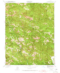
1978 Map of Cazadero
USGS Topo · Published 1978About this map
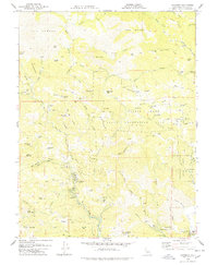
Cazadero and the surrounding Russian River hinterlands are shown here in the late 1970s, characterized by a mix of deep-canyon ranching and early recreational retreats. The topography is dominated by the complex drainage of Austin Creek and East Austin Creek, where the terrain transitions from the wooded ridges of The Big Brush to the serpentinite barrens of The Cedars. This landscape supported a unique economy of isolated homesteads like the Luttrell Ranch and Akinori Ranch, alongside established social institutions such as Camp Royaneh and the Berkeley Music Camp Pond. Conservation efforts are well-established on this sheet, anchored by the Armstrong Redwoods State Reserve, which protects the massive Col Armstrong Tree. Significant local landmarks like the Red Oat Mtn Lookout provide a sense of the logistical efforts required to manage this wildfire-prone redwood and oak forest environment.
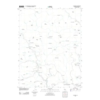
Find a feature on this map
108 named features on this map. Tap any name to fly to it.
Don’t see what you’re looking for? This feature index may not catch every label — zoom into the map to look around manually.
Map Details
Editions of this 1978 Cazadero Map
This is the sole edition of this map. No revisions or reprints were ever made.
Historical Maps of Goat Rock Through Time
8 maps found