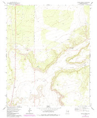
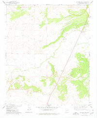
1977 Map of Ceadro Spring
USGS Topo · Published 1985About this map
The Zuni River carves a winding path through this high-desert landscape in Apache County, defining the drainage patterns that shaped local land use. This 1970s survey, updated in the early 1980s, reveals a terrain where water is the primary driver of human presence. Named water sources like Ceadro Spring, Jaralosa Spring, and Ceadro Well stand out as critical landmarks in an otherwise arid expanse. A singular Jeep Trail and a scattered network of improvements, including the Ortega Well and Rim Tank, suggest a landscape managed for ranching or livestock. The presence of a Borrow Pit near the western edge indicates localized material extraction, likely for the maintenance of the nearby roads that skirt the river's edge. This map is a clear record of the infrastructure required to sustain activity in the desert plateau before modern developments reached this corner of Arizona.
Find a feature on this map
11 named features on this map. Tap any name to fly to it.
Don’t see what you’re looking for? This feature index may not catch every label — zoom into the map to look around manually.
Map Details
Editions of this 1977 Ceadro Spring Map
2 editions found
Other maps of this area

1886 · St Johns
USGS Topo · 1:250,000

1892 · St Johns
USGS Topo · 1:250,000

1954 · Saint Johns
USGS Topo · 1:250,000

1957 · Saint Johns
USGS Topo · 1:250,000

1958 · Saint Johns
USGS Topo · 1:250,000

1962 · Saint Johns
USGS Topo · 1:250,000
1977 · Ceadro Spring
USGS Topo · 1:24,000
1978 · Fairchild Well
USGS Topo · 1:24,000
1978 · Barth Well
USGS Topo · 1:24,000
1978 · Schnebly Well
USGS Topo · 1:24,000