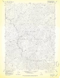
1978 Map of Cecilville
USGS Topo · Published 1978About this map
The Salmon River and its South Fork anchor this 1970s survey of the California wilderness, showing a landscape defined by isolated homesteads and deep-rooted mining activity. While Cecilville remains the primary settlement, the map documents the historical footprint of the area through the Yoakumville (Site) and various family holdings like Godfrey Ranch and Blue Ridge Ranch. The proximity of numerous extraction sites, including the King Solomon Mine, Starveout Mine, and Gunbarrel Mine, speaks to the region's long-standing reliance on the mineral wealth found within the Klamath National Forest.
Find a feature on this map
52 named features on this map. Tap any name to fly to it.
Don’t see what you’re looking for? This feature index may not catch every label — zoom into the map to look around manually.
Map Details
Editions of this 1978 Cecilville Map
This is the sole edition of this map. No revisions or reprints were ever made.
Other maps of this area

1948 · Weed
USGS Topo · 1:250,000

1950 · Weed
USGS Topo · 1:250,000

1955 · Salmon Mtn
USGS Topo · 1:62,500

1955 · Cecilville
USGS Topo · 1:62,500

1955 · Sawyers Bar
USGS Topo · 1:62,500

1955 · Forks of Salmon
USGS Topo · 1:62,500

1958 · Weed
USGS Topo · 1:250,000

1963 · Weed
USGS Topo · 1:250,000
1977 · Tanners Peak
USGS Topo · 1:24,000
1978 · Forks of Salmon
USGS Topo · 1:24,000