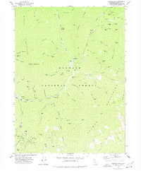
1977 Map of Tanners Peak
USGS Topo · Published 1978About this map
The Klamath National Forest serves as the backdrop for this intensive record of hard-rock mining and hydraulic activity along the North Fork Salmon River. The landscape is densely packed with mineral claims, ranging from the curiously named One Hundred Dollar Mine to the Uncle Sam Mine and Lanky Bob Mine. These operations follow the deep incisions of gulches like Eddy Gulch and Whites Gulch, where Dredge Tailings indicate the scale of industrial displacement along the riverbed.
Find a feature on this map
76 named features on this map. Tap any name to fly to it.
Don’t see what you’re looking for? This feature index may not catch every label — zoom into the map to look around manually.
Map Details
Editions of this 1977 Tanners Peak Map
This is the sole edition of this map. No revisions or reprints were ever made.
Other maps of this area

1886 · Shasta
USGS Topo · 1:250,000

1894 · Shasta
USGS Topo · 1:250,000

1923 · Sawyers Bar
USGS Topo · 1:125,000

1931 · Etna
USGS Topo · 1:96,000

1934 · Etna
USGS Topo · 1:125,000

1948 · Weed
USGS Topo · 1:250,000

1950 · Weed
USGS Topo · 1:250,000

1955 · Cecilville
USGS Topo · 1:62,500

1955 · Sawyers Bar
USGS Topo · 1:62,500

1955 · Etna
USGS Topo · 1:62,500