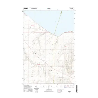
2015 Map of Cedar
USGS Topo · Published 2015About this map
Lake Superior dominates the northern horizon of this landscape, where the administrative boundary of Ashland Co Iron Co cuts southward through dense terrain. The settlement of Cedar serves as a local anchor in the southeast, while smaller communities like Birch Hill and Birch are linked by a network of rural roads including Resvn Hwy 5 and Old Hwy 10. The topography is defined by numerous drainage systems, such as Graveyard Cr and Sugarbush Cr, which flow toward the Great Lake. In the northwest corner, the Bad River Slough marks a transition into more wetland-rich coastal environments near Lake Rd. This modern survey illustrates the persistent rural character of the region, where family and place names like Franks Field and landmarks such as Marble Point reflect a long-standing relationship between the community and the lake-shore environment.
Find a feature on this map
35 named features on this map. Tap any name to fly to it.
Don’t see what you’re looking for? This feature index may not catch every label — zoom into the map to look around manually.
Map Details
Editions of this 2015 Cedar Map
This is the sole edition of this map. No revisions or reprints were ever made.
Other maps of this area

1940 · Upson
USGS Topo · 1:48,000

1942 · Mellen
USGS Topo · 1:48,000

1943 · Upson
USGS Topo · 1:48,000

1943 · Little Girl Point
USGS Topo · 1:48,000

1943 · Odanah
USGS Topo · 1:48,000

1945 · Odanah
USGS Topo · 1:48,000

1945 · Mellen
USGS Topo · 1:48,000

1953 · Ashland
USGS Topo · 1:250,000
1956 · Saxon
USGS Topo · 1:24,000
1956 · Little Girls Point
USGS Topo · 1:62,500